
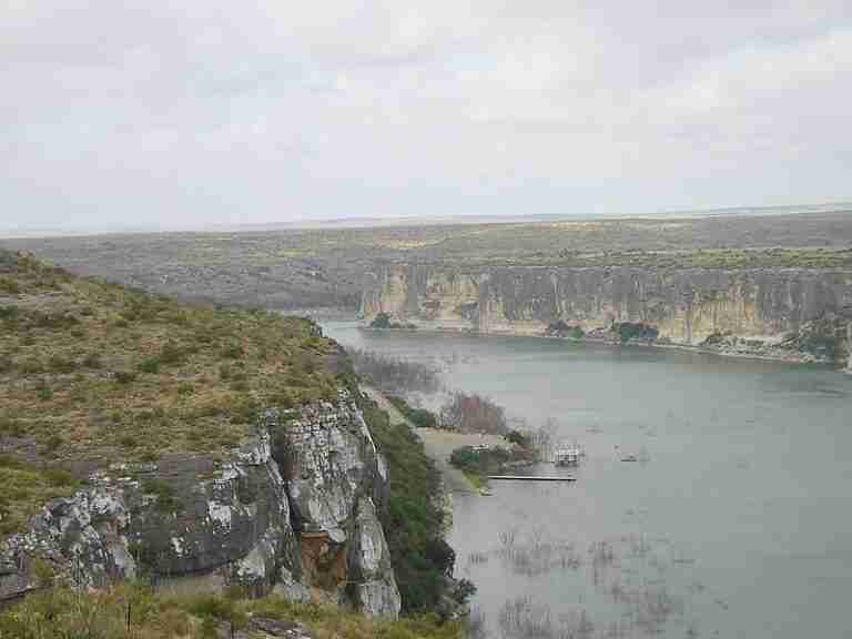
The Pecos River originates in Mora County, north-central New Mexico, in the Sangre de Cristo Mountains, at an elevation exceeding 12,000 feet. From there it flows about 926 miles (1,490 km) through eastern New Mexico and western Texas before emptying into the Rio Grande near Del Rio, Texas. Along its Texas course, the river acts as a boundary stream in several segments, such as between Loving and Reeves counties and Reeves and Ward counties. The valley through which the river flows in Texas contains extensive alluvial deposits and underlying aquifers, including the Cenozoic Pecos Alluvium aquifer that underlies parts of Crane, Ector, Loving, Pecos, Reeves, Upton, Ward, and Winkler counties.
Historical and Cultural Significance
The Pecos River has long been a geographical feature around which human activity formed. Native American groups used its waters and surrounding lands for sustenance and travel. Later, European explorers and settlers crossed the region, recognizing the river as both a resource and a challenge in the harsh desert environment. The river lent its name to the frontier phrase “West of the Pecos,” a term that came to symbolize the rugged and untamed side of the American frontier. Water rights along the river have also shaped regional development. The Pecos River Compact, signed in 1948 and approved by Congress in 1949, governs the allocation and management of the river’s waters between New Mexico and Texas. A more recent Supreme Court ruling reaffirmed obligations under the compact, ensuring cooperative water management across state lines.
Geology and Landscape Features
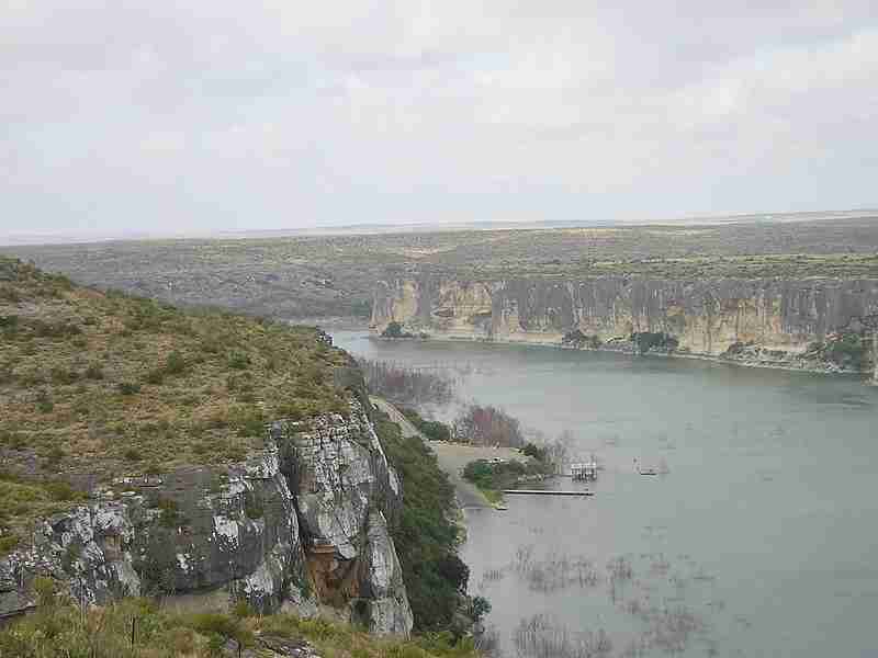
As the Pecos River descends from its mountain origins into the arid plains of West Texas, its landscape changes dramatically. In its lower course, the river has carved a deep canyon more than 1,000 feet (300 meters) in places during its final 125 miles before meeting the Rio Grande. The valley’s geology includes thick layers of alluvium—clay, sand, gravel, and caliche—over older rock formations dating back to the Permian, Triassic, and Cretaceous periods. These features tell the story of an evolving desert landscape shaped by millions of years of uplift, erosion, and sedimentation.
Ecology and Conservation
Although much of the Pecos River region is semi-arid to arid, the corridor supports a surprising diversity of plant and animal life. Riparian zones along the river are home to cottonwoods, mesquite, and saltcedar, while the surrounding terrain hosts hardy desert species such as creosote and yucca. The river’s ecosystem supports several rare and endangered species, including the Pecos gambusia, a small fish found only in parts of the Pecos basin in Texas and New Mexico. Conservation initiatives such as the Pecos Watershed Conservation Initiative focus on habitat restoration, water-quality improvements, and species protection. These efforts reflect growing recognition of the river’s ecological importance within an otherwise dry region.
Present-Day Relevance
Today, the Pecos River remains vital for agriculture, ranching, and wildlife. It provides water to farms, supports native habitats, and attracts recreation such as fishing, boating, and hiking. Managing the river’s resources continues to be a complex challenge, balancing agricultural use, oil and gas development, and environmental conservation. The Pecos River Compact remains central to these efforts, defining the responsibilities of both New Mexico and Texas. Ongoing studies of the valley’s aquifer systems help ensure sustainable water use in a region where every drop counts.
Photos:
Map:
Sorry, no records were found. Please adjust your search criteria and try again.
Sorry, unable to load the Maps API.
Verhalen
Texas
79772
United States
true
- Hiking
- Birdwatching
- Fishing
- Camping
- Picnic areas
- Restrooms
- Information center