

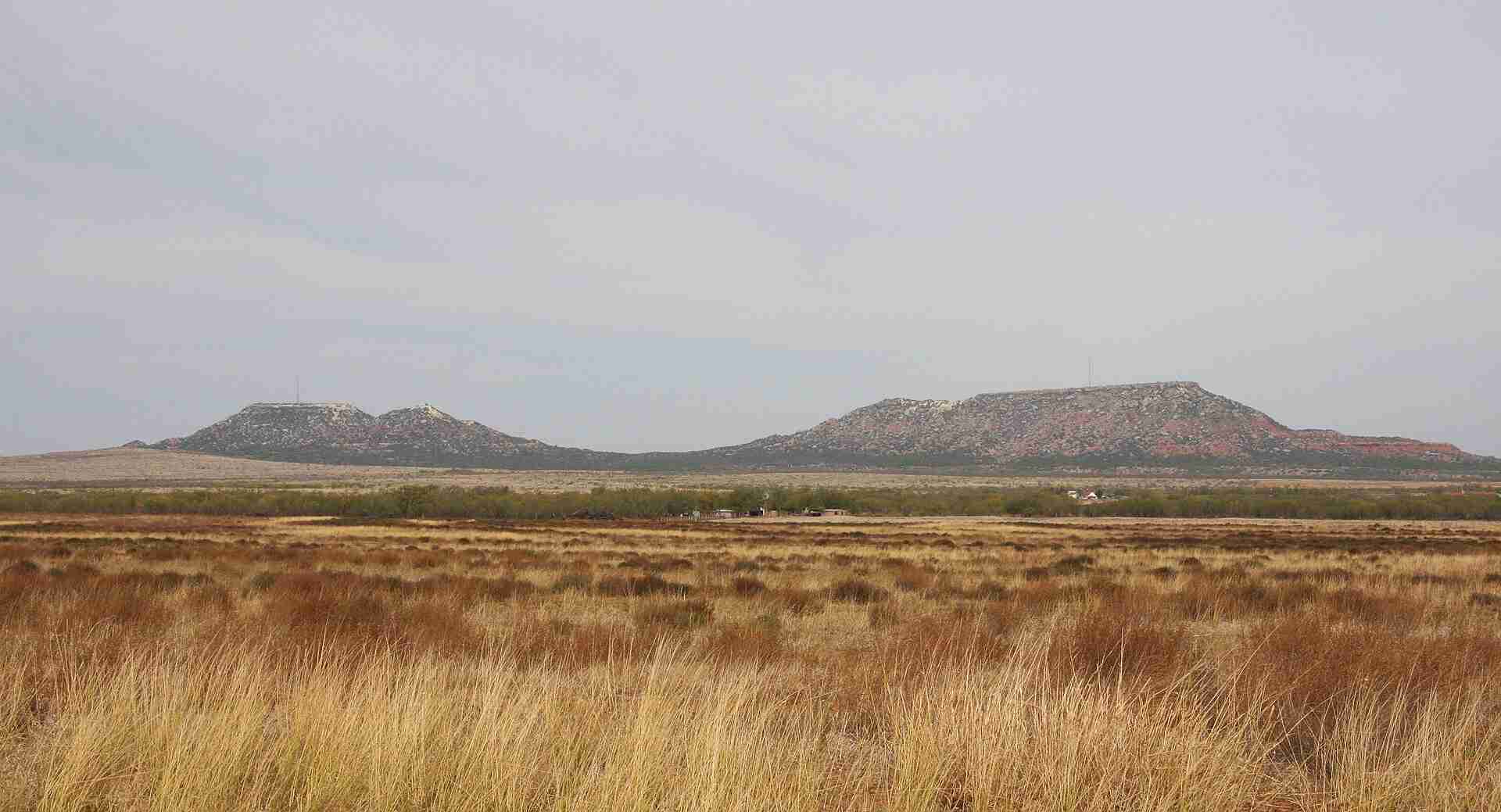
The Double Mountains rise about 13 miles southwest of Aspermont in Stonewall County, Texas. These twin flat-topped buttes stand out prominently above the surrounding plains, forming one of the most recognizable landmarks in West Texas. The eastern summit reaches an elevation of roughly 2,580 to 2,600 feet (786–792 meters), making it the highest point in the county. Their broad, flat summits and steep sides reflect their formation as erosional remnants of the Cretaceous period, composed primarily of sedimentary rock from the Comanche Series. Because of their height and isolation, the Double Mountains can be seen from many miles away, often serving as visual guides for travelers and ranchers navigating the plains.
Geology and Prominence
Geologically, the Double Mountains are classic examples of buttes shaped by erosion, where wind and water gradually stripped away softer rock layers and left the harder formations intact. They rise several hundred feet above the surrounding terrain and represent the remnants of an ancient landscape that once stretched across the region. Their topographic prominence is remarkable—they are the most prominent landforms within nearly 160 miles, with the next more prominent peak being Mount Scott in Oklahoma. This combination of height and isolation makes the Double Mountains an important geographic reference point across the Rolling Plains.
Historical Significance
The Double Mountains have held historical importance since the 19th century. In 1849, U.S. Army officer Randolph B. Marcy mentioned the buttes in his survey of the area while mapping routes to the American West. They later served as navigational markers for settlers, trail drivers, and buffalo hunters moving through the region. According to some historical accounts, Comanche leader Quanah Parker and his band once lived near the mountains, and the peaks were considered sacred by the Comanche people. Their visibility across the plains gave them both practical and cultural meaning for those who passed nearby.
Access and Modern Use
Access to the Double Mountains is available by way of Farm to Market Roads 2211 and 610, with unpaved roads leading closer to the bases of the buttes. The eastern summit hosts a radio tower, continuing the site’s role as a point of reference and communication in the region. The surrounding land remains largely private, consisting of ranchland that preserves much of the area’s open landscape. Despite the limited public access, the buttes remain a favored subject for photography, history enthusiasts, and anyone interested in Texas geography.
The Lost Town of Double Mountain
A small community named Double Mountain once existed a few miles north of the buttes. Founded in 1886, the town had a post office, school, and several churches. Like many small rural settlements, it declined through the 20th century as residents moved to larger towns, and by the 1980s, it had become a ghost town. Today, little remains of the community except traces on old maps and a few foundations, leaving the buttes themselves as the lasting namesake of the area.
Role in the Brazos River Watershed
The Double Mountains play an important role in the hydrology of West Texas. They mark the divide between the Salt Fork and the Double Mountain Fork of the Brazos River, helping shape the flow of water that eventually joins to form one of Texas’s major river systems. This natural divide has influenced local drainage patterns and continues to define part of the regional landscape.
Photos:
Map:
Sorry, no records were found. Please adjust your search criteria and try again.
Sorry, unable to load the Maps API.
Stonewall County
Texas
79546
United States
Yes
- Hiking
- Birdwatching
- Photography
- Parking area
- Picnic spots
- Wildlife observation areas
Leaflet, Double Mountain viewed from south 2009, CC BY-SA 3.0