
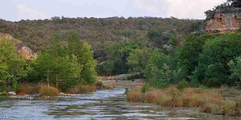
The Upper Guadalupe – Nichol’s Landing Paddling Trail covers 9.9 miles of the upper Guadalupe River in Comal County, Texas. This stretch is known for clear water, steady flow, and varied terrain. The route moves through a corridor of mature trees, limestone cliffs, and broad shelves carved by the river over time. Paddlers experience a mix of calm stretches and sections of fast water that reflect changing river depth and gradient. Under typical conditions, the full trip takes between three and six hours.
River Features and Notable Rapids
The trail includes several rapids that require attention and preparation. About one and a half miles below the FM 311 crossing, paddlers reach Mueller Falls, where a chute to the left of an island creates a quick and narrow run. It is one of the best known features along this route and is widely mentioned in official descriptions. Additional fast-water sections appear farther downstream, shaped by rock formations and shifting channels. Water levels and flow rates determine how technical each rapid becomes, so checking conditions before entering is important.
Natural Scenery Along the Route
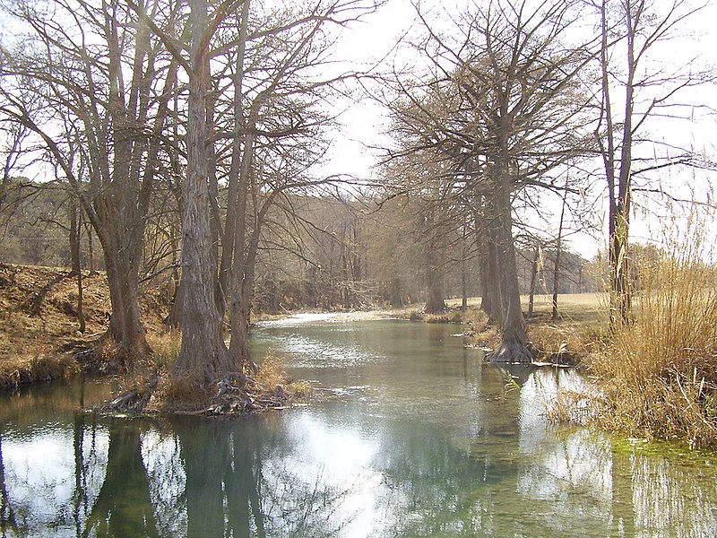
The landscape along the river supports tall bald cypress, pecan, cottonwood, elm, and oak trees. Their shade and size contribute to the character of this section of the Guadalupe. Limestone shelves rise beside the river in many areas, creating natural steps and ledges that define the shoreline. Together, these features create consistent scenic interest throughout the paddling trail.
Wildlife and Local Ecology
This portion of the Guadalupe River provides habitat for a range of wildlife. Sightings may include deer, raccoons, foxes, armadillos, and squirrels near the banks. River beavers have also been observed in this area. The variety of plant life and steady water flow support fish and aquatic species, and the environment attracts many bird species commonly found in Central Texas waterways.
Photos:

Map:
Sorry, no records were found. Please adjust your search criteria and try again.
Sorry, unable to load the Maps API.
Spring Branch
Texas
78070
United States
Specific pet policies for the Upper Guadalupe – Nichol's Landing Paddling Trail are not readily available. As this trail is part of the Texas Paddling Trails system, it's advisable to contact the Texas Parks and Wildlife Department or local authorities for current pet policies before your visit.
- Paddling: Enjoy canoeing or kayaking along the 9.9-mile trail, featuring a mix of calm waters and exciting rapids.
- Fishing: The Guadalupe River is home to various fish species, offering opportunities for anglers.
- Wildlife Viewing: Observe local flora and fauna in their natural riverine habitats.
- Swimming: Certain areas along the river are suitable for swimming; always exercise caution and be aware of current conditions.
- Parking: Limited to 20 vehicles; parking is in designated areas only.
- Restrooms: Portable toilets are available on-site.
- Picnic Areas: While there are no formal picnic facilities, visitors can find natural spots along the riverbank to relax.