
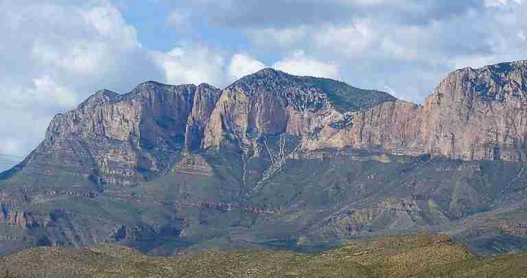
Shumard Peak rises to 8,615 feet above sea level, making it one of the highest points in Texas. Located within Guadalupe Mountains National Park in far West Texas, the peak is part of the rugged Guadalupe Mountains range that defines the state’s highest elevations. The mountain is known for its remote location, steep slopes, and striking limestone formations. Because no maintained trail reaches the summit, it remains one of the least-visited peaks in the park.
Naming and History
The peak is named after George Getz Shumard, a 19th-century geologist and surgeon who explored the Trans-Pecos region during geological surveys in the 1850s. His work, along with that of his brother Benjamin Franklin Shumard, helped document the complex geology of West Texas and contributed to early scientific understanding of the region’s ancient formations. The naming of Shumard Peak honors George’s contributions to Texas geology.
Location and Elevation
Situated west of Guadalupe Peak, the state’s highest point, Shumard Peak shares the same ancient limestone foundation that characterizes the entire Guadalupe range. It sits near other notable summits such as Bush Mountain, which stands at 8,631 feet, and Bartlett Peak. Together, these form a chain of high ridges overlooking the Chihuahuan Desert below.
Geology and Terrain
Shumard Peak’s structure is primarily composed of Permian limestone, part of the fossilized Capitan Reef system that formed roughly 260 million years ago when the area was covered by a shallow inland sea. The weathered cliffs and ridgelines reveal layers of marine fossils and sediment that tell the story of an ancient ocean long vanished. This geological heritage makes the Guadalupe Mountains one of the most studied fossil reef systems in North America.
Access and Hiking Conditions
Reaching Shumard Peak is a demanding effort that requires strong navigation skills and endurance. There are no official or marked trails leading to the summit. Experienced hikers often begin at established trailheads such as Pine Springs or Tejas Trail, following maintained paths only part of the way before navigating off-trail across rugged, rocky terrain. The steep slopes are covered in desert vegetation, including prickly pear and sotol, making progress slow and challenging. Due to its isolation, hikers should carry detailed maps, GPS devices, and sufficient water, as the region is dry and conditions can change rapidly.
Scenery and Surroundings
The summit offers wide views of the Chihuahuan Desert, neighboring Bush Mountain, and the vast open spaces of West Texas. From its high ridges, visitors can see the dramatic contrast between the green juniper and pinyon-covered upper slopes and the arid desert floor below. Sunrises and sunsets from the surrounding ridges are particularly vivid, illuminating the ancient limestone cliffs in gold and red hues.
Flora and Fauna
Though the peak itself sees little human traffic, its surrounding habitat supports a range of desert and mountain species. Mule deer, golden eagles, and a variety of smaller mammals inhabit the region, while the elusive mountain lion roams the higher elevations. The vegetation shifts from desert scrub at lower levels to woodlands of ponderosa pine and alligator juniper as elevation increases, reflecting the diverse ecosystems within the park.
Significance
Shumard Peak represents both the beauty and the difficulty of Texas’s mountain wilderness. It stands as a natural monument to the state’s geological past and offers a rare experience for those seeking solitude and challenge. Its remote character ensures that it remains one of the most pristine and untouched high points in the Lone Star State.
Photos:
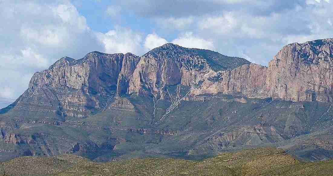
Shumard Peak
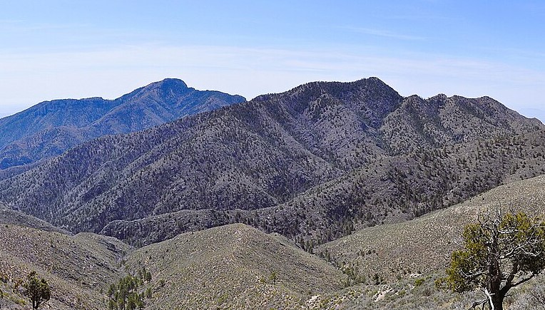
Bush Mountain Trail
Map:
Sorry, no records were found. Please adjust your search criteria and try again.
Sorry, unable to load the Maps API.
Salt Flat
Texas
79847
United States
- Pets are not allowed on the trails or in the backcountry.
- Backcountry hiking
- Wilderness camping
- Wildlife viewing
- Photography
- Backcountry campsites (permits required)
- Marked trails leading toward the peak (off-trail required for summit)
- Visitor center at Pine Springs for permits and information
Zereshk, Shumard from south, CC BY-SA 3.0
Fredlyfish4, Shumard Peak from Bush Mountain Trail, CC BY-SA 3.0