
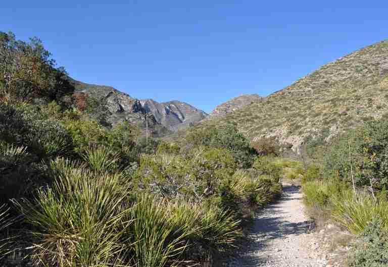
McKittrick Ridge Trail lies within Guadalupe Mountains National Park in West Texas, an area celebrated for its rugged landscapes and striking elevation changes. The trail begins at the McKittrick Canyon Trailhead and extends roughly 15.2 miles round-trip, climbing about 2,700 feet from the canyon floor to the high ridge. The route follows a steep and rocky path that rewards hikers with wide views of McKittrick Canyon and the surrounding peaks. Because of the steep grade and length, the National Park Service classifies it as a strenuous hike suited for those with solid backcountry experience.
The Route and Terrain
The hike starts in the lower canyon, where oak, maple, and juniper trees thrive in the cooler, shaded environment. As the trail gains altitude, the terrain transitions into desert scrub and pinyon pine forests, reflecting the park’s diverse ecosystems. Midway up the route, hikers reach a scenic overlook known as “The Notch,” a natural opening between cliffs that offers panoramic views in both directions. Beyond this point, the path becomes more exposed and demanding, climbing toward the ridge crest with several false summits before the final approach to the top.
Camping on the Ridge
At the upper end of the trail, backpackers will find the McKittrick Ridge Wilderness Campground. This designated backcountry site provides a remote overnight option for hikers who wish to split the journey over two days. The park recommends carrying all needed supplies, particularly water, as there are no reliable natural sources along the trail. Clear skies and high elevation make the ridge an exceptional spot for stargazing, with sweeping views of the surrounding desert and mountains.
Geological and Natural Highlights
Guadalupe Mountains National Park preserves one of the most significant fossil reef systems in the world, known as the Capitan Reef. This ancient limestone formation dates back about 260 million years to the Permian period, when the region was covered by a shallow inland sea. The exposed rock layers along McKittrick Ridge reveal part of this remarkable geological history. The trail also passes through habitats that support mule deer, golden eagles, and a variety of desert plants adapted to the park’s arid climate.
A Trail of Rewarding Effort
The McKittrick Ridge Trail is one of the park’s most demanding routes, offering a blend of physical challenge and scenic payoff. The steep climb, changing landscapes, and high-elevation views provide a vivid sense of the park’s natural beauty. For those prepared with proper gear, endurance, and planning, it remains one of Texas’s most memorable backcountry hikes.
Photos:
Map:
Sorry, no records were found. Please adjust your search criteria and try again.
Sorry, unable to load the Maps API.
Salt Flat
Texas
79847
United States
No. Pets are not permitted on trails to protect wildlife and natural habitats.
-
Strenuous hiking
-
Backcountry camping (permit required)
-
Wildlife observation
-
Photography
-
Parking at trailhead
-
Information kiosks
-
Wilderness campground (primitive)