
The El Paso Tin Mines Trail is an out-and-back route in Franklin Mountains State Park on the north side of El Paso, Texas. It follows an old access road through Chihuahuan Desert terrain to the ruins of the El Paso Tin Mining and Smelting Company, widely cited as the only tin mine ever operated in the United States. The main route commonly used by hikers is about 6.5 to 6.8 miles round trip, with an elevation gain of roughly 1,000 to 1,040 feet, which most visitors complete in about three hours at a steady pace.
Franklin Mountains State Park itself covers more than 24,000 acres, making it one of the largest urban parks in the United States. The park’s desert peaks, canyons, and open vistas rise to North Franklin Peak at 7,192 feet, providing a dramatic setting for the trail and its historic destination.
Trail Route, Difficulty, and Use
The hike begins near Chuck Heinrich Memorial Park and follows the old Tin Mine Road toward the base of the Franklin Mountains. The path climbs gradually through desert foothills before steepening as it approaches the mine area high on the flank of North Franklin Mountain. The route is generally clear and well defined, though the final stretch up to the mine entrances can be rocky and uneven.
Most guide sources rate the El Paso Tin Mines Trail as moderate in difficulty. The distance, cumulative elevation gain, and full sun exposure are the main challenges rather than technical terrain. Hikers report that fit visitors can complete the round trip in about three hours, although many allow extra time to rest, enjoy the views, and look over the mining ruins.
The trail is popular with hikers and mountain bikers, and it connects with a broader network of multi-use routes within Franklin Mountains State Park. Dogs are permitted on the trail as long as they are kept on a leash, in accordance with park regulations.
History of the El Paso Tin Mines
The site reached by the trail is the former location of the El Paso Tin Mining and Smelting Company on the northeast slope of North Franklin Mountain. Historical accounts agree that the company began operations in 1909 and ceased work in 1915 after failing to produce tin in commercially viable amounts.
Although production was limited, the site has lasting historical importance because it is regarded as the only tin mining and smelting operation ever established in the United States. Today, visitors can see remnants of this early 20th-century industrial site, including adits, tunnel entrances, and scattered ruins on the slopes above the main path. These remains offer a rare look at a short-lived but significant effort to develop a domestic source of tin during a time when nearly all the world’s supply came from overseas.
Geology and Desert Landscape
The Franklin Mountains form a striking geologic backdrop for the El Paso Tin Mines Trail. The range is a tilted block-fault mountain system, with ancient rock layers uplifted and exposed along steep faults. It is composed mainly of sedimentary rocks such as limestone and sandstone, along with igneous intrusions including granite and volcanic materials. These formations record more than a billion years of Earth’s history, featuring some of the oldest exposed rocks in Texas.
Along the trail, visitors pass through a characteristic Chihuahuan Desert landscape filled with yucca, prickly pear cactus, and other drought-adapted plants. The open terrain and increasing elevation provide broad views of El Paso and the surrounding desert basin. Together, the desert vegetation, exposed rock formations, and weathered mine workings create a hike that blends natural beauty with historical intrigue—all within the boundaries of El Paso itself.
Photos:

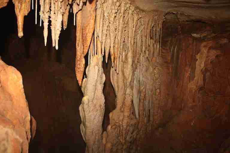
Rock formation
Map:
Sorry, no records were found. Please adjust your search criteria and try again.
Sorry, unable to load the Maps API.
El Paso
Texas
79930
United States
Yes, pets are welcome but must be kept on a leash.
-
Hiking: The trail offers a moderately challenging hike suitable for various skill levels.
-
Mountain Biking: The trail is popular among mountain bikers seeking a scenic ride.
-
Backpacking: The area is frequented by backpackers exploring the Franklin Mountains.
-
Parking: Available at the trailhead within the Tom Mays Unit.
-
Restrooms: Facilities are located near the parking area.
-
Picnic Areas: Designated spots equipped with tables are available for visitors.