
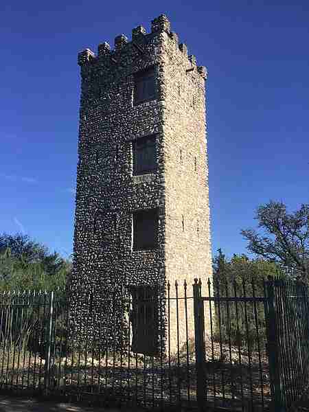
El Camino Real de los Tejas National Historic Trail preserves a network of historic routes that connected Mexico City to the frontier regions of Texas and Louisiana. These pathways were used from the late seventeenth century through the nineteenth century and supported settlement, commerce, diplomacy, and military activity across a wide stretch of the Spanish colonial world. The trail was designated a National Historic Trail in 2004 and represents one of the most important transportation systems in early Texas history. Its corridor supported the movement of Indigenous peoples, Spanish officials, French traders, Mexican authorities, and later Anglo-American settlers, shaping cultural and economic development throughout the region.
Historical Importance of the Trail
The trail served as the primary route linking central New Spain with its northeastern frontier. Spanish missionaries, soldiers, and administrators traveled these roads while establishing missions and presidios that extended royal influence into what is now Texas. Indigenous nations such as the Caddo interacted frequently with travelers, participating in trade and diplomacy. As time passed, the same route carried settlers arriving from both Mexico and the United States, making it a major factor in demographic change. By the early nineteenth century, it supported regional commerce and movement during the Texas Revolution and the early years of the Republic of Texas.
The Trail in the Texas Landscape
The Texas portion of El Camino Real de los Tejas covered roughly 540 miles and passed through diverse terrain, from the wooded hills of East Texas to the plains around San Antonio and the coastal region near Goliad. Although the original path shifted over the centuries, many communities formed along the corridor. Visitors today can still experience portions of the route through preserved sites, reconstructed missions, historic towns, and natural areas that provide a sense of the environments early travelers encountered.
Mission Espíritu Santo and Goliad State Park
Mission Nuestra Señora del Espíritu Santo de Zúñiga played a prominent role in Spanish settlement efforts. Founded in 1722 near Matagorda Bay, the mission moved twice before reaching its permanent site at present-day Goliad in 1749. There, it became known for developing large-scale ranching operations that influenced the growth of cattle culture in Texas. The reconstructed mission at Goliad State Park presents the daily life of mission residents and explains how the institution supported Spanish presence along the trail.
San Antonio Missions National Historical Park
San Antonio emerged as a key center along El Camino Real de los Tejas. Its mission system began in the early eighteenth century, with Mission Concepción, Mission San José, Mission San Juan, and Mission Espada forming the heart of Spain’s religious and administrative efforts in the region. These missions introduced European construction methods, irrigation techniques, and agricultural practices. Their location along the trail made San Antonio a gathering point for travel, communication, and trade. Today, the preserved missions reflect a long history of cultural blending between Indigenous communities and Spanish settlers.
Presidio La Bahía
Established in 1749 at its current location in Goliad, Presidio Nuestra Señora de Loreto de la Bahía protected mission communities and guarded the surrounding region. The presidio later became central to events of the Texas Revolution. The Goliad Massacre of 1836, one of the turning points in the fight for independence, took place nearby. The site now serves as a museum that interprets Spanish military life and the presidio’s connection to the historic trail.
Bastrop and the McKinney Roughs Corridor
Bastrop developed near a portion of the trail used by travelers moving between central and eastern Texas. The surrounding landscape includes areas that reflect the natural settings early travelers would have crossed. McKinney Roughs Nature Park offers a look at the woodlands and river valleys that shaped movement through this part of the trail network. The region’s ecology adds valuable context to how geography influenced travel and settlement patterns.
Mission Dolores in San Augustine
Mission Nuestra Señora de los Dolores de los Ais, founded in 1717 in East Texas, served the Ais people and provided Spain with a foothold near important Caddoan settlements. Although abandoned for periods during the eighteenth century, the site played a role in Spain’s efforts to maintain influence in the region. The present-day visitor center in San Augustine explains the mission’s history and its relationship to the broader network of El Camino Real de los Tejas.
Caddo Mounds State Historic Site
Caddo Mounds State Historic Site preserves the remains of a major Caddoan settlement dating from roughly 800 to 1300. Long before Spanish arrival, this community supported ceremonial, political, and trade activities. The Caddo later became important partners and negotiators as European powers entered East Texas. The site provides insight into Indigenous cultures that shaped the region’s history and interacted with travelers along the trail.
Nacogdoches and Its Historic Role
Nacogdoches traces its roots to a long-standing Caddoan settlement and was officially established as a Spanish town in 1779 by Antonio Gil Y’Barbo. Its location along El Camino Real de los Tejas made it a crossroads for Spanish, French, and later Anglo-American traders. Throughout the nineteenth century, the town became a hub of commerce, political activity, and migration. Visitors can still see historic buildings, cemeteries, and local museums that reflect centuries of change along the route.
San Antonio de Béxar and the Alamo
Founded in 1718, San Antonio de Béxar became the administrative and population center of Spanish Texas. Mission San Antonio de Valero, later known as the Alamo, stood at the heart of the community. The Alamo eventually became a prominent military site and gained international recognition after the 1836 battle during the Texas Revolution. Its earlier mission period and later military history illustrate the continuous importance of the trail to political and cultural developments in Texas.
Los Adaes in Louisiana
Located near the Texas border, Los Adaes was designated the capital of Spanish Texas from 1729 until 1772. It served as a defensive outpost against French expansion from nearby Natchitoches and acted as a waypoint for travelers along the eastern extent of the trail. The site preserves the remains of the presidio and settlement that once anchored Spanish authority in the region.
Ongoing Preservation and Public Access
Efforts to preserve the trail involve cooperation among the National Park Service, state agencies, local communities, and private organizations. While much of the original route lies beneath modern highways or has been altered by development, significant segments remain identifiable. Parks, museums, and historic sites across Texas and Louisiana provide opportunities to understand the trail’s pathways and the communities that grew along them. These preserved locations offer visitors a clear sense of how the corridor shaped the social and political landscape of early Texas.
Photos:
Map:
Sorry, no records were found. Please adjust your search criteria and try again.
Sorry, unable to load the Maps API.
Goliad
Texas
77963
United States
- General Areas: The trail spans various sites across Texas and Louisiana, each with its own pet policies.
- Guidelines: Pet policies vary by site along the trail. Visitors should check with individual sites or refer to the official website for specific guidelines.
- Historical Exploration: Visit preserved missions, such as those within the San Antonio Missions National Historical Park, to learn about early Spanish colonial life.
- Hiking and Biking: Certain segments of the trail offer opportunities for outdoor recreation, allowing visitors to experience the historic route firsthand.
- Educational Programs: Participate in ranger-led tours, workshops, and interpretive programs that delve into the trail's history and significance.
- Visitor Centers: Several sites along the trail feature visitor centers with exhibits, informational materials, and restrooms.
- Museums: Explore museums that house artifacts and provide insights into the trail's historical context.
- Picnic Areas: Designated spots are available at various locations for visitors to rest and enjoy meals.