

The San Gabriel River in Central Texas is a scenic waterway that begins where the North and South Forks merge in Georgetown. Both forks originate in Burnet County and flow eastward through Williamson and Milam Counties. The combined river continues its course for roughly 50 miles before joining the Little River about five miles south of Cameron. The San Gabriel River system plays an important role in the region’s landscape, connecting the limestone hills of the Edwards Plateau with the fertile soils of the Blackland Prairie.
Reservoirs and Water Management
Two major reservoirs regulate the river’s flow and provide water storage, flood control, and recreation. Lake Georgetown, located on the North Fork, was completed in 1979 by the U.S. Army Corps of Engineers. Downstream, Granger Lake serves a similar purpose and is also managed by the Corps. These reservoirs supply drinking water to nearby communities, support aquatic habitats, and offer boating, swimming, and fishing opportunities throughout the year.
Recreation and Trails
In Georgetown, the San Gabriel River serves as a natural centerpiece for outdoor recreation. San Gabriel Park, a large green space near downtown, features open fields, picnic areas, sports facilities, disc golf, and shaded walking paths. The San Gabriel River Trail extends approximately 6.6 miles, following both forks of the river through wooded terrain and limestone bluffs. The trail’s combination of paved and natural surfaces makes it suitable for walking, running, and cycling. Anglers frequent the river’s calm pools and bends in search of largemouth bass, catfish, and sunfish. Paddlers also enjoy sections of the river when water levels permit, especially in the stretch between Lake Georgetown and Granger Lake.
Ecology and Landscape
The San Gabriel River’s surroundings reflect Texas’s unique ecological transition. Its upper reaches cut through the rocky, spring-fed terrain of the Hill Country, characterized by clear water and exposed limestone. As the river flows east, it enters the Blackland Prairie, where clay-rich soils support bottomland forests and grasslands. Oak and pecan trees are common along the riverbanks, providing shade and habitat for birds, deer, and other wildlife. Seasonal rains influence the river’s flow, bringing periods of swift current followed by calm pools that sustain a variety of plant and animal species.
Historical Significance
The San Gabriel River valley has a long history of human settlement. Indigenous peoples lived along its banks for centuries, using the waterway for food, transportation, and trade. In the 18th century, Spanish missionaries established several missions near the river in what is now Milam County. These included Mission San Francisco Xavier de Horcasitas and Mission San Ildefonso, founded in the late 1740s. Though short-lived, the missions marked one of the earliest European presences in Central Texas. Today, remnants of this era remain part of the area’s cultural heritage, linking the modern river corridor with its deep historical roots.
Photos:
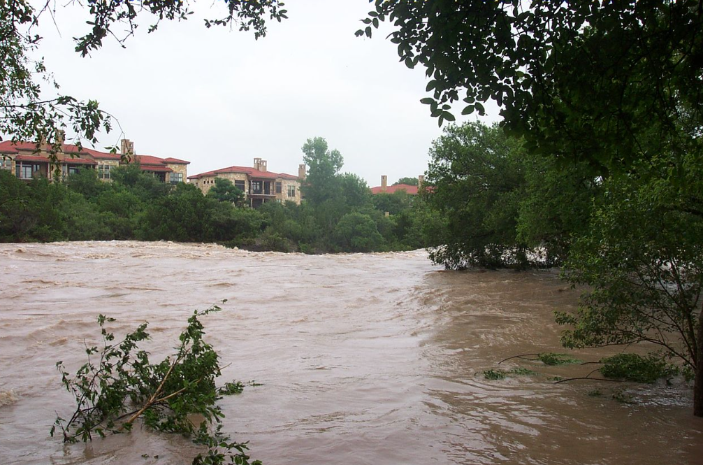
San Gabriel River
Map:
Sorry, no records were found. Please adjust your search criteria and try again.
Sorry, unable to load the Maps API.
Thorndale
Texas
76577
United States
Yes; pets are welcome in parks along the river but must be kept on a leash.
-
Hiking
-
Biking
-
Fishing
-
Canoeing
-
Kayaking
-
Bird watching
-
Picnicking, and disc golf.
Trails, picnic areas, playgrounds, sports fields, fishing spots, and restrooms.