
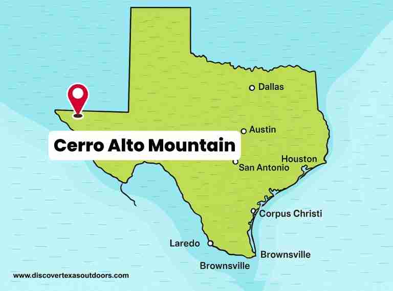
Cerro Alto Mountain is the highest point in the Hueco Mountains of far western Texas. Located in Hudspeth County, it rises about 45 miles west of Dell City and lies east of El Paso along U.S. Route 180. The mountain reaches an elevation of roughly 6,700 feet above sea level, with published figures ranging between 6,703 and 6,787 feet. It is a landmark of the desert landscape, forming part of the rugged terrain that separates the Tularosa Basin from the Hueco Bolson.
Geography and Setting
The Hueco Mountains stretch across northwestern Hudspeth County and extend into El Paso County near the New Mexico border. Cerro Alto Mountain stands near the northern end of the range, where the terrain rises abruptly from desert flats covered with desert scrub and sparse grass. The area is characterized by wide-open vistas, rocky slopes, and shallow, stony soils that support hardy vegetation such as creosote bush, yucca, and grama grass. Despite its arid environment, the region provides essential habitat for desert wildlife, including mule deer, jackrabbits, and a variety of reptiles and birds.
Geology
Geologically, Cerro Alto Mountain is part of the Hueco Mountains formation, composed primarily of limestone deposited during the Permian period over 250 million years ago. These ancient marine rocks formed in a shallow sea that once covered much of what is now West Texas. The mountain’s limestone layers are rich in fossils, offering evidence of coral, sponges, and shellfish that lived in that long-vanished sea. Erosion and faulting have since shaped the range into the sharp ridges and steep slopes visible today. There is no verified evidence that Cerro Alto Mountain is a laccolith or volcanic structure; its origin is sedimentary and tectonic rather than igneous.
Ecology
The desert ecosystem surrounding Cerro Alto Mountain reflects the extremes of the Trans-Pecos region. Vegetation is sparse but resilient, adapted to withstand drought and temperature swings. Creosote, mesquite, prickly pear cactus, and ocotillo dominate the lower slopes, while grasses and small shrubs appear at higher elevations. Rainfall is scarce, averaging less than 12 inches per year, but summer monsoons occasionally bring bursts of life to the desert floor. The area remains largely undeveloped, providing a glimpse into the natural landscape of West Texas before extensive ranching and settlement.
Cultural Context
While the Hueco Mountains region has long been inhabited by Indigenous peoples, direct references connecting Cerro Alto Mountain itself to specific tribal traditions are limited in verified records. The Tigua (Ysleta del Sur Pueblo), whose historic homeland includes parts of the El Paso area, maintain a deep spiritual connection to the land and nearby mountain ranges. However, no formal documentation confirms a distinct ancestral or spiritual association specifically tied to Cerro Alto Mountain. The broader region, including the Hueco Tanks area to the southwest, does hold archaeological and cultural significance due to its ancient rock art and long history of habitation.
Significance and Visibility
Cerro Alto Mountain stands as a prominent landmark in far West Texas. Its summit offers panoramic views of the desert plains and the Hueco Mountains extending southward. The mountain is visible from long distances across the basin, particularly from the east side of El Paso on clear days. Although it remains relatively unknown compared to other West Texas peaks, it forms a striking feature in the state’s geological and ecological landscape, representing both the endurance and beauty of the Trans-Pecos region.
Photos:

Map:
Sorry, no records were found. Please adjust your search criteria and try again.
Sorry, unable to load the Maps API.
Butterfield
Texas
79938
United States
Access to Cerro Alto Mountain is restricted due to private ownership; therefore, pet policies are not publicly available.
Due to its private ownership, there are no designated recreational activities available on Cerro Alto Mountain.
There are no public amenities on Cerro Alto Mountain.